


Geographic Information System
Mô tả của Geographic Information System
Ứng dụng là một cuốn sổ tay hoàn chỉnh miễn phí của Hệ thống Tin học Địa lý bao gồm tất cả các chủ đề quan trọng với ghi chú chi tiết, sơ đồ, phương trình, công thức và tài liệu khóa học.
Ứng dụng này có 100 chủ đề với ghi chú chi tiết, sơ đồ, phương trình, công thức và tài liệu khóa học, các chủ đề được liệt kê trong 5 chương. Ứng dụng phải có cho tất cả sinh viên khoa học kỹ thuật
Tải xuống Ứng dụng làm tài liệu tham khảo & sách kỹ thuật số cho các chương trình Dân dụng & kỹ thuật khác và các khóa học cấp bằng.
Ứng dụng được thiết kế để học nhanh, sửa đổi, tham khảo tại thời điểm kiểm tra và phỏng vấn.
Ứng dụng này bao gồm hầu hết các chủ đề liên quan và Giải thích chi tiết với tất cả các chủ đề cơ bản.
Một số chủ đề được đề cập trong ứng dụng Hệ thống Thông tin Địa lý này là:
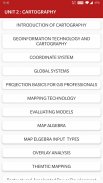
1. GIỚI THIỆU VỀ GIS
2. GIS để tính toán địa lý
3. Tạo điều kiện thuận lợi về công nghệ
4. CÁC CHỨC NĂNG CƠ BẢN CỦA GIS
5. ĐỊNH NGHĨA HỆ THỐNG CỦA GIS
6. Khoa học GIS và Sự trỗi dậy của Kỹ thuật Thông tin Địa lý
7. KHOA HỌC GIS ĐỂ THEO DÕI
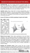
8. CÁC VẤN ĐỀ VỀ GISCIENCE NHƯ LỰA CHỌN NHÓM CÁC TRỢ GIÚP
9. GIỚI THIỆU SƠ ĐỒ
10. CÔNG NGHỆ HÌNH HỌC VÀ SƠ ĐỒ
11. HỆ THỐNG PHỐI HỢP
12. CÁC HỆ THỐNG TOÀN CẦU
13. CƠ SỞ DỰ ÁN CHO CÁC CHUYÊN VIÊN GIS
14. QUY MÔ BẢN ĐỒ
15. DỰ ÁN BẢN ĐỒ
16. SỰ BIẾN ĐỔI HÌNH HỌC
17. VECTOR VÀ DỮ LIỆU RASTER
18. SAPATIAL PHENOMENON CỦA GIS
19. CHỨC NĂNG DỮ LIỆU SPATIAL
20. CÔNG NGHỆ THU THẬP DỮ LIỆU
21. CẢM BIẾN TỪ XA
22. KHẢO SÁT MẶT BẰNG
23. Vai trò và Bản chất của Mô hình Môi trường
24. BỐI CẢNH CỦA MÔ HÌNH MÔI TRƯỜNG
25. TÓM TẮT VỀ PHÁT TRIỂN MÔ HÌNH
26. CÁC MÔ HÌNH ÁP DỤNG
27. MÔ HÌNH ĐẤT
28. MÔ HÌNH ĐỊA HÌNH
29. CÁC LOẠI MÔ HÌNH
30. CÁC CÁCH TIẾP CẬN ĐỂ LẬP MÔ HÌNH
31. ĐẠI DIỆN VÀ TÍNH TOÁN ĐỘNG HỌC ĐỊA LÍ.
32. LẬP MÔ HÌNH TẠM THỜI
33. GIS TẠM THỜI
34. KHÁI NIỆM VỀ CƠ SỞ DỮ LIỆU
35. THIẾT KẾ CƠ SỞ DỮ LIỆU
36. KỸ THUẬT ĐẦU VÀO DỮ LIỆU
37. KHAI THÁC DỮ LIỆU
38. HỆ THỐNG ĐỊNH VỊ TOÀN CẦU (GPS)
39. SO SÁNH SỰ TĂNG CƯỜNG VÀ KHỬ MÙI
40. BỐ TRÍ BẢN ĐỒ
41. CÁC YẾU TỐ BỐ TRÍ BẢN ĐỒ
42. HOÀN THIỆN BẢN ĐỒ VÀ CÁC YÊU CẦU
43. CÔNG NGHỆ KỸ THUẬT
44. CÔNG NGHỆ SƠ ĐỒ
45. CÁC MÔ HÌNH ĐÁNH GIÁ
46. ĐẠI SỐ BẢN ĐỒ
47. CÁC LOẠI ĐẦU VÀO CỦA BẢN ĐỒ ELGEBRA
48. PHÂN TÍCH QUÁ TRÌNH
49. VECRTOR VÀ RASTER OVERLAY
50. LẬP MÔ HÌNH TARAIN
51. GIAO DIỆN KHÔNG GIAN
52. CHỨC NĂNG CHUYỂN
53. GIS & MẠNG NÔNG THÔN NHÂN TẠO
54. MẠNG
55. GIS VÀ PHÂN TÍCH MẠNG
56. ỨNG DỤNG NGUỒN NƯỚC CỦA GIS
57. MÔ HÌNH THỦY LỰC
58. GIS VÀ XÃ HỘI
59. GIS VÀ VẬN CHUYỂN
60. GIS CƠ SỞ ĐÁNH GIÁ CÁC ĐẶC ĐIỂM ĐỊA CHẤT
61. KẾT CẤU ĐỊA CHẤT
62. TẠO DỮ LIỆU SPATAIL TRONG GIS
63. SƠ ĐỒ WEB
64. TẦM QUAN TRỌNG CỦA THIẾT KẾ DỰA WEB
65. PHÂN TÍCH TÁC ĐỘNG MÔI TRƯỜNG
66. DỊCH VỤ BẢN ĐỒ
67. HÌNH THÀNH VÀ PHÁT TRIỂN HỆ THỐNG GIÁM SÁT EFA
68. GIS TRONG QUẢN LÝ TIỆN ÍCH
69. SƠ ĐỒ THEMTIC
70. Cải cách và phát triển điện được tái cấu trúc-tăng tốc được lập trình
71. GIS TRONG QUẢN LÝ TIỆN ÍCH
72. SƠ ĐỒ THEMTIC
73. Cải cách và phát triển điện được tái cấu trúc-tăng tốc được lập trình
74. SƠ ĐỒ ẢNH
75. SƠ ĐỒ DI ĐỘNG
Tất cả các chủ đề không được liệt kê vì giới hạn ký tự.
Đặc trưng :
* Chủ đề hoàn thành chương khôn ngoan
* Bố cục giao diện người dùng phong phú
* Chế độ đọc thoải mái
* Chủ đề kỳ thi quan trọng
* Giao diện người dùng rất đơn giản
* Bao gồm hầu hết các chủ đề
* Một cú nhấp chuột để có được Tất cả Sách liên quan
* Nội dung được tối ưu hóa cho điện thoại di động
* Hình ảnh được tối ưu hóa cho thiết bị di động
Mỗi chủ đề có đầy đủ các sơ đồ, phương trình và các dạng biểu diễn đồ họa khác để giúp học tập tốt hơn và hiểu nhanh hơn.
Ứng dụng này sẽ hữu ích để tham khảo nhanh chóng. Việc sửa đổi tất cả các khái niệm có thể được hoàn thành trong vòng vài giờ sử dụng ứng dụng này.
Thay vì đánh giá thấp hơn cho chúng tôi, vui lòng gửi thư cho chúng tôi các thắc mắc, vấn đề của bạn và cung cấp cho chúng tôi Xếp hạng và Đề xuất có giá trị Để chúng tôi có thể xem xét nó cho các Bản cập nhật trong tương lai. Chúng tôi sẽ rất vui khi giải quyết chúng cho bạn.
Geographic Information System - Phiên bản 11.0
(10-09-2024)Geographic Information System - Thông tin APK
Phiên bản APK: 11.0Gói: engg.hub.geoinformatics.systemPhiên bản mới nhất của Geographic Information System
Phiên bản khác


Ứng dụng cùng danh mục
 4.484.274.334.364.46
Bạn cũng có thể thích...


